Caption
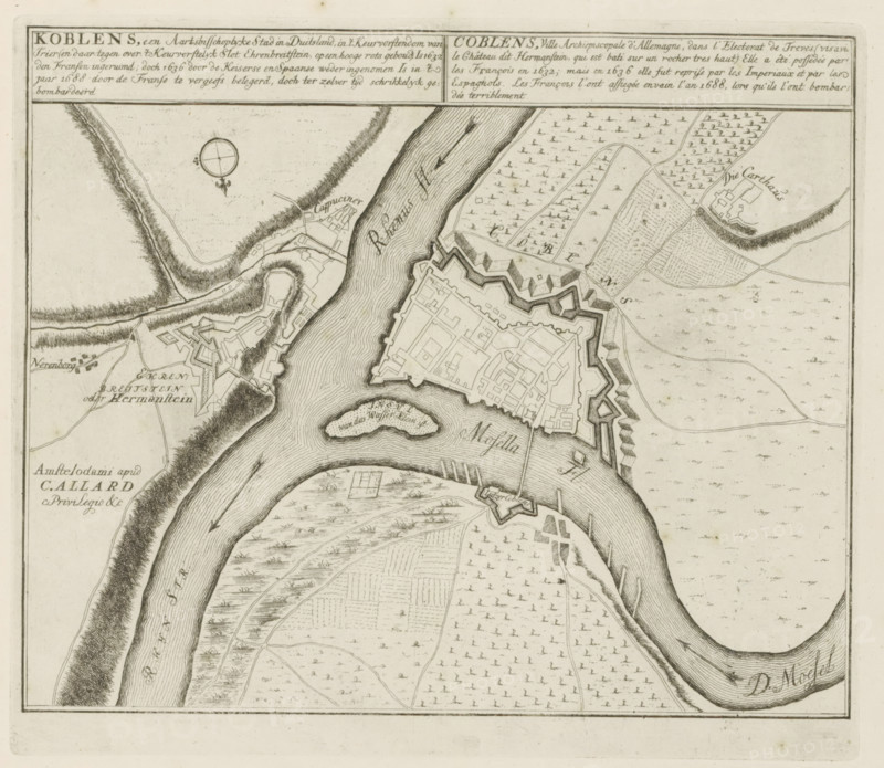
Koblenz, an archiepiscopal city in Germany, Map of Koblenz, The Principal Fortifications & Fortresses of Spain, France, Italy, Savoy, Germany & the Netherlands, Accurate Illustrations of the Main Strong Cities and Fortresses in Spain, Germany and the Netherlands, print, album page, map, Map of the fortifications around the German city of Koblenz. With texts in Dutch and French., printmaker: Abraham Allard, Amsterdam, printmaker: Carel Allard, publisher: Pieter van der Aa (I), Leiden, grantor of privilege: States of Holland and West Friesland, 1702 - 1733, paper, etching, height 241 mm x width 278 mm, fortifications, military engineering, maps of cities, War of Spanish Succession, Rhineland-Palatinate, Period, 1701 - 1713, A detailed black and white engraved map showing a winding river with textured ripple lines, fortified walls with angular bastions surrounding a town, dense clusters of small rectangular buildings within the fortifications, an island in the river with concentric contour lines, fields marked with repetitive small tree or crop symbols, thin winding roads connecting scattered structures, shaded banks and hachured hills along the river, a compass rose, and various small isolated buildings and enclosures outside the fortified area.
Credit line
Photo12/Liszt Collection
Reference
LZT26B29_158
License type
Rights managed
Available size
53.1Mb (9.0Mb) / 15.4in x 13.4in / 4622 x 4016 (300dpi)