Caption
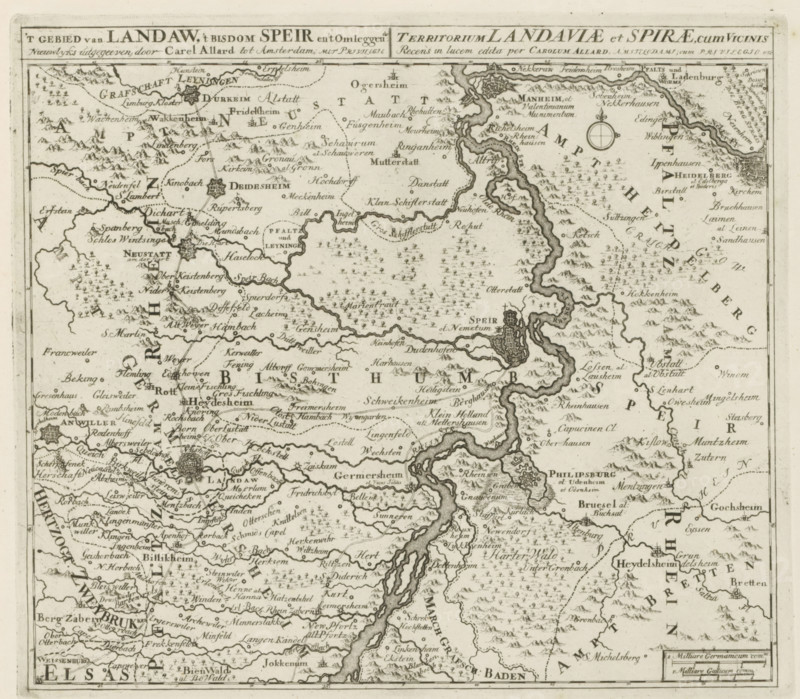
t Landaw area, the diocese of Speir and the surrounding area, Landauiae et Spirae territory, cum Vicinis, Map of the region between Mannheim and Landau, Les Principales Forteresses & Villes Fortes, d'Espagne, de France, d'Italie, Savoia, d'Allemagne & des Païs-Bas, Accurate Images of the Most Important Strong Cities and Fortresses in Spain, France, Italy, Savoy, Duytsland and the Netherlands, print, album page, map, Map of the region between Mannheim, Speyer and Landau. With texts in Dutch and Latin., printmaker: Abraham Allard, Amsterdam, printmaker: Carel Allard, publisher: Carel Allard, publisher: Pieter van der Aa (I), Leiden, grantor of privilege: States of Holland and West Friesland, 1701 - 1733, Abraham Allard, Carel Allard, Pieter van der Aa (I), States of Holland and West Friesland, publisher, grantor of privilege, paper, etching, height 245 mm x width 279 mm, maps of separate countries or regions, War of Spanish Succession, Rhineland-Palatinate, Baden-Württemberg, Landau in der Pfalz, Speyer, Mannheim, Period, 1701 - 1713, A detailed monochrome engraved map showing winding rivers with textured banks, irregularly shaped regions separated by dotted and solid boundary lines, clusters of small stylized trees and mountain symbols, numerous small pictorial town markers with fortified walls and towers, a compass rose with ornate fleur-de-lis ornament, scattered tiny buildings and churches with steeples, densely packed handwritten-looking place labels throughout, decorative cartographic border lines framing the sheet, and varied hachure shading used to indicate terrain.
Credit line
Photo12/Liszt Collection
Reference
LZT26B29_155
License type
Rights managed
Available size
52.5Mb (11.2Mb) / 15.3in x 13.4in / 4579 x 4005 (300dpi)