Caption
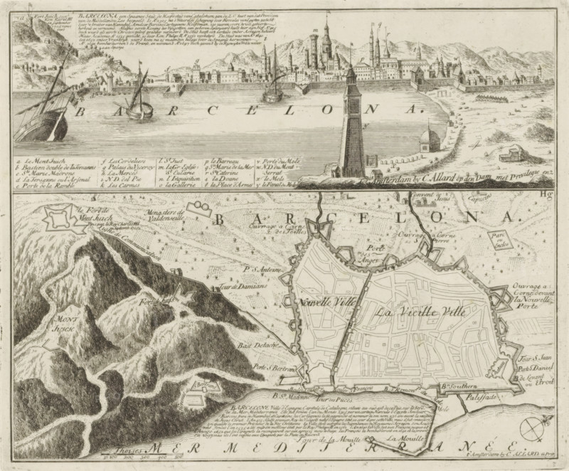
View and map of Barcelona, Barcelona, a Spanish city, the capital of Catalonia, Les Principales Forteresses & Villes Fortes, d'Espagne, de France, d'Italie, de Savoie, d'Allemagne & des Païs-Bas, Naaukeurige Illustratie der Voornaamste Sterke Steden en Vestingen in Spanjen, Vrankryk, Italien, Savoyen, Duytsland en Nederlanden, print, album page, map, View of the city of Barcelona with a map of the same city underneath. With texts in Dutch and French., printmaker: Abraham Allard, Amsterdam, printmaker: Carel Allard, publisher: Carel Allard, publisher: Pieter van der Aa (I), Leiden, grantor of privilege: States of Holland and West Friesland, 1701 - 1733, Abraham Allard, Carel Allard, Pieter van der Aa (I), States of Holland and West Friesland, publisher, grantor of privilege, paper, etching, height 233 mm x width 282 mm, fortifications, military engineering, maps of cities, War of Spanish Succession, Catalonia, Barcelona (city), Period, 1701 - 1713, An engraved map fragment showing a coastal city and surrounding terrain, with a waterfront view at the top featuring a long fortified sea wall, a tall lighthouse or tower near the shore, several sailing ships in the water, and a dense cluster of spired and gabled buildings behind the walls; below that, a detailed plan of the walled city with streets, bastions and fortifications, labeled areas, and a grid of narrow blocks; to the left and lower left, hilly and mountainous terrain rendered with contour shading and winding paths, with a small detached fortress on a hill; the coastline with beaches, scattered rocks and small structures runs between the sea view and the city plan, and a decorative compass rose appears near the lower right edge.
Credit line
Photo12/Liszt Collection
Reference
LZT26B29_137
License type
Rights managed
Available size
48.0Mb (10.8Mb) / 15.0in x 12.4in / 4503 x 3728 (300dpi)