Caption
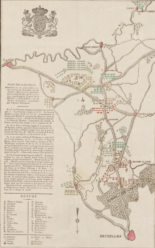
Plan des Batailles Données le 15, 17, 17 et 18 Iuin 1815, aux environs de Bruxelles, par les Armées Aliées sous le commandement en chef du Duc de Wellington, remportant la Victortoire de la Belle-Alliance, sur les Armées Francaises, commandées par Napoléon Buonaparte, Kaart met de veldslagen bij Quatre-Bras en Waterloo, 15-18 juni, 1815, print, map, Kaart van de streek tussen Brussel en Charleroi waar tussen 15-18 juni 1815 veldslagen waren uittussen tussen de armies van de Geallieerden en het French army under Napoleon. Op de kaart zijn de strijdorde van de armieden. With a description of the battles and a legend in French. The various places and armies indicated in colors., printmaker, Netherlands, paper, etching, woodcut, letterpress printing, hand coloring, etching and engraving, the coat of arms in woodcut and the text in letterpress, partly hand-colored, height 380 mm x width 255 mm, Person, Napoleon I (Emperor of the French), Arthur Wellesley or Wellington, maps of separate countries or regions, battle arrays, Battle of Waterloo, Belgium, Period, 1815-06-15 - 1815-06-18, An antique map printed on beige paper showing a winding river, roads, villages, fields, clusters of rectangular colored blocks, and scattered trees, with small circular and diamond-shaped markers in pink, green, and red; a decorative coat of arms with two lions and a crowned shield appears near the top, while a column of dense printed text and a key occupy the left side; the map includes clustered small building shapes, dotted and dashed lines indicating routes, varied shaded areas representing wooded terrain, and compass-like ornamentation near the lower center, with a larger pink shaded area at the bottom labeled by printed letters.
Credit line
Photo12/Liszt Collection
Reference
LZT26B21_335
License type
Rights managed
Available size
34.2Mb (7.1Mb) / 9.1in x 14.6in / 2730 x 4377 (300dpi)