Caption
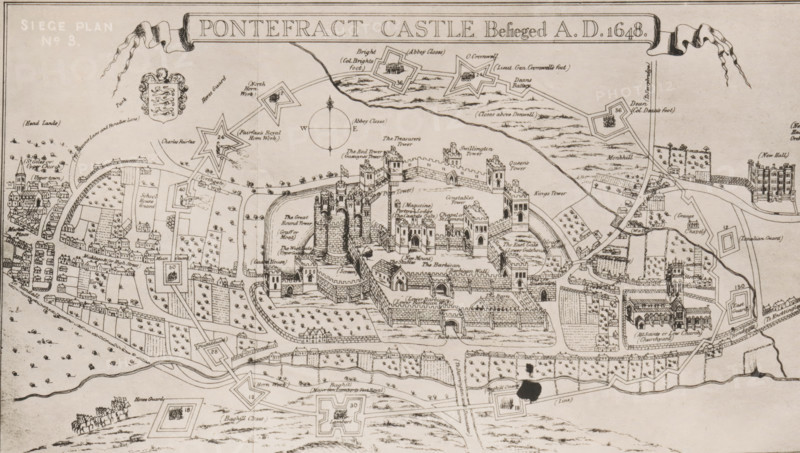
Reproduction of a print of a siege plan of the Siege of Pontefract, reproduction, page, photomechanical print, cliché maker: Autotype Company, The (possibly), after print by anonymous, c. 1882 - in or before 1887, photographer, after print by, paper, collotype, photogravure, height 105 mm x width 181 mm, Print on fourth unnumbered page after page 412., siege, maps of cities, Siege of Pontefract, Pontefract, A wide, detailed black-and-white historical map shows a fortified castle complex with concentric walls, multiple towers of various shapes, and a central cluster of circular keep towers on raised ground. Surrounding the castle are rows of small buildings and houses, enclosed courtyards, orchards with regularly spaced trees, and rectangular garden plots. Star-shaped earthworks and angular bastions appear on the outskirts, connected by winding roads and pathways that cross open fields. Small clusters of clustered houses and church buildings with steeples sit beyond the walls, and several detached structures and rectangular enclosures dot the landscape. A decorative compass rose is drawn near the top center, and a ribbon-like banner stretches across the top edge. The map is rendered with fine linework, hatching for texture, and small pictorial details such as trees, fences, and tiny groups of figures and animals in some open areas. There is a dark ink blot near the lower center of the image.
Credit line
Photo12/Liszt Collection
Reference
LZT26B09_079
License type
Rights managed
Available size
33.7Mb (6.8Mb) / 15.2in x 8.6in / 4559 x 2583 (300dpi)