Caption
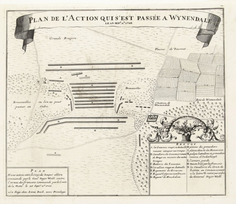
Plan of the Battle of Wijnendale, 1708, Plan de l'Action qui s'est passée a Wynendale de 28 sep.e aé. 1708, print, map, Map of the battle on September 28, 1708 at Wijnendale in West Flanders between the Allied troops under Major General Webb, who were escorting a convoy, and French troops under Count de la Mott. Printed on the sheet below the plate an account of the battle in 2 columns in French and 2 columns in Dutch., printmaker, publisher, grantor of privilege, The Hague, Northern Netherlands, paper, etching, letterpress printing, etching with text in letterpress, height 578 mm x width 445 mm, Compare the almost identical print by Jacobus Harrewijn in: Table des cartes des Pays-Bas et des frontieres de France, avec un recueil des plans des villes, sieges et battailles données entre les hauts allies et la France, Eugene Henry Fricx, Brussels 1712, maps of separate countries or regions, battle (land forces), Battle of Wijnendale (1708), Wijnendale, Period, 1708-09-28, Aged map fragment showing a large decorative ribbon banner across the top with bold serif lettering, a textured field area with small dot and dash marks, multiple long rectangular bars arranged in parallel rows across the center, scattered small circular tree-like symbols forming groves and clusters, an area of neatly hatched rectangular plots resembling cultivated fields to the right, thin winding lines indicating paths or roads, a small square fortification symbol near the lower right with simple geometric walls, a large ornamental cartouche with scrollwork and floral motifs at the lower right edge, bordered panels containing dense columns of small text blocks, and a simple compass bar near the lower center.
Credit line
Photo12/Liszt Collection
Reference
LZT26A95_328
License type
Rights managed
Available size
53.6Mb (11.9Mb) / 15.5in x 13.4in / 4649 x 4031 (300dpi)