Caption
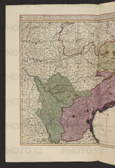
Praefectura generalis Languedociae olim Occitania dicta, cujus partes, superior sive occidentalis, et orientalis inferior, atque ad Aquilonem tractus Cebenicus vulgo les Sevennes sunt, primam quarum praeter suos in Archiepiscopatum Tolosanum, Albianensemque, Comitatum Fuxii, alteram Narbonense, Archiepiscopatum, Ambarumque porro, ut et tertia parte in varias primariarum earundem urbium dicecese atq. regiones episcopalenses, exacte hacce tabula disitinxit. Gerard Valck 1651/1652–1726 and Pieter Schenck 1660–1711, map of Languedoc France, 1711, Amsterdam; map; height 48.7 cm, width 57.7 cm., An antique map page showing a large rectangular map with a pale cream background surrounded by a thin red border and wider off-white margins, depicting a region divided into multiple irregularly shaped areas filled with different pale colors; a group of areas are shaded green and another group are shaded pink, with thin dark outlines separating them and additional pale yellow and subtle blue tints visible along some borders. The map surface is densely covered with fine black printed markings and small symbols forming a network of lines and shapes, with a few darker decorative spots and small shaded relief-like markings. A narrow strip along the right edge shows an adjacent map section with a pale blue coastal area and darker navy accents at the waterline, and the map rests on a textured dark background visible around the outer edges. The paper shows slight discoloration and warm beige tones toward the margins, and the overall palette includes cream, off-white, green, pink, pale yellow, blue, navy, black, red, and beige.
Credit line
Photo12/Liszt Collection
Reference
LZT26A06_313
License type
Rights managed
Available size
70.6Mb (7.1Mb) / 13.7in x 20.0in / 4114 x 6000 (300dpi)