Caption
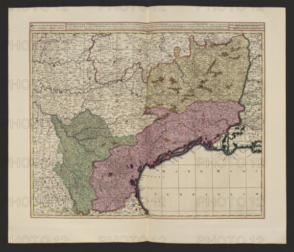
Praefectura generalis Languedociae olim Occitania dicta, cujus partes, superior sive occidentalis, et orientalis inferior, atque ad Aquilonem tractus Cebenicus vulgo les Sevennes sunt, primam quarum praeter suos in Archiepiscopatum Tolosanum, Albianensemque, Comitatum Fuxii, alteram Narbonense, Archiepiscopatum, Ambarumque porro, ut et tertia parte in varias primariarum earundem urbium dicecese atq. regiones episcopalenses, exacte hacce tabula disitinxit. Gerard Valck 1651/52–1726 and Pieter Schenck 1660–1711, map of Languedoc France, 1711; map; height 48.7 cm, width 57.7 cm., A rectangular, aged paper map with a pale beige background and darker beige border area, showing a coastal region with a large sea area at the bottom right colored a very light tan; the land is divided into several irregular regions shaded in muted green, muted pink, and pale yellow, each outlined in thin colored lines. The map contains a dense array of tiny printed place marks and short lines indicating settlements and roads, and numerous small brown hill symbols clustered across the pale yellow region. The coastline is irregular and detailed with darker ink along the shore and a narrow band of darker shading where the land meets the sea. Fine grid lines and faint rectangular panels are visible over the sea area, and the entire map is framed by thin double border lines in red and black. The paper has a central vertical fold and a horizontal fold near the bottom, and there is slight aging discoloration near the center fold.
Credit line
Photo12/Liszt Collection
Reference
LZT26A06_312
License type
Rights managed
Available size
88.4Mb (8.7Mb) / 20.0in x 17.2in / 6000 x 5150 (300dpi)