Caption
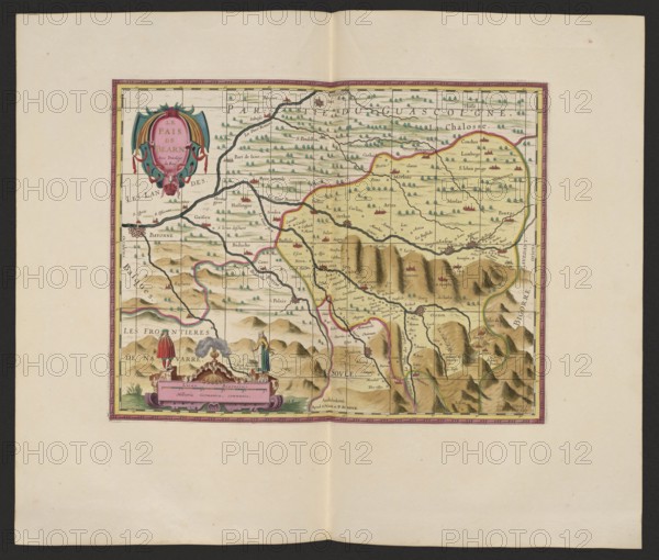
Le pais de Bearn; cartographic map of Béarn, France Aquitaine; makers: Pieter Schenck 1660–1711 and Gerard Valck 1651/1652–1726 publishers; date: 1711; place of publication: Amsterdam; medium: map; dimensions: height 37.6 cm, width 47.5 cm., A colored map centered on a rectangular cartographic area surrounded by a decorative border, placed on a light beige sheet with a darker outer margin; the map area shows a landscape with rolling hills and a range of jagged mountains rendered in brown and tan shading, interspersed with small green tree symbols across flatter areas, and several winding dark blue rivers and thin pink and yellow boundary lines. In the upper left of the map area is an ornate cartouche featuring teal and pink drapery and red decorative elements. Near the lower edge of the map area is a decorative panel in pink with two small standing human figures flanking a smoking brazier atop a low plinth, and additional small sculptural elements and greenery nearby. The overall palette includes beige, brown, tan, green, blue, pink, teal, red, and black for outlines and fine details.
Credit line
Photo12/Liszt Collection
Reference
LZT26A06_310
License type
Rights managed
Available size
87.7Mb (7.0Mb) / 20.0in x 17.0in / 6000 x 5109 (300dpi)