Caption
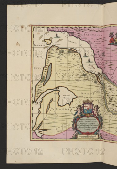
La Riviere de la Garomne et la Dordogne et la pays aux environs de Bourdeavx; map of France Bordeaux area, 1711; cartography by Pieter Schenck 1660–1711 and Gerard Valck 1651/52–1726; map; dimensions: height 43.0 cm, width 51.8 cm., A colored map fragment on aged paper with a cream background and a dark border, showing coastal and inland shapes filled with pale yellow, pink, and tan regions outlined in black and orange. A vertical strip of pink runs along the right edge, and a large pale yellow landmass occupies the center and left with darker tan contour shading and small green tree-like marks. Several blue-gray and greenish water bodies are inset within the land, and small stylized ships and wavy water strokes appear in the surrounding sea areas. There is an ornate cartouche near the lower right decorated with cherub-like figures in flesh tones, blue and pink drapery, and a small heraldic shield with red and blue sections, all accented with gold and green embellishments. Thin black grid lines and coast-hugging outlines, plus scattered tiny pictorial symbols and clusters of fine black markings, cover the map surface. The outer margins show light brown foxing spots and a few darker stains on the cream paper.
Credit line
Photo12/Liszt Collection
Reference
LZT26A06_305
License type
Rights managed
Available size
71.0Mb (5.7Mb) / 13.8in x 20.0in / 4135 x 6000 (300dpi)