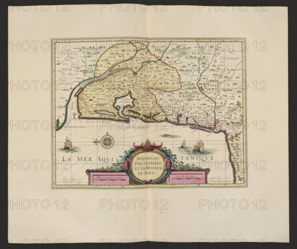
Caption
Bovrdelois, Pays de Médoc et la prevosté de Born; Gerard Valck 1651/1652–1726, publisher; Pieter Schenck 1660–1711, publisher; cartography/map of Bordeaux region, France; 1711; map; 37.6 cm × 48.0 cm., A rectangular map centered on a pale cream sheet with a narrow decorative border, showing a coastal region with land colored in pale yellow and green, outlined in thin brown and pink lines, and scattered small green tree symbols and tiny red-roofed building icons; the coastline is irregular with inlets and peninsulas, and the sea below the land is a light blue-gray with darker blue-gray shading for waves; ornamental elements include a multi-colored compass rose with green, red, and gold tones, several small sailing ships in brown and cream with white sails on the water, and a large ornate cartouche at the bottom center decorated in pink, blue, green, and gold with floral and scroll motifs; faint grid lines span the sea area, and thin black lines trace rivers and boundaries on the land, with small clusters of green trees and scattered brown and red markings across the interior.
Credit line
Photo12/Liszt Collection
Reference
LZT26A06_299
License type
Rights managed
Available size
86.3Mb (6.7Mb) / 20.0in x 16.8in / 6000 x 5026 (300dpi)