Caption
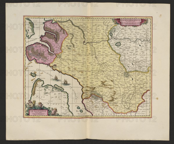
La Saintonge vers le Midy auecq. le Brovageais, terre d'Arvert &C.; Gerard Valck 1651/52–1726 and Pieter Schenck 1660–1711, publishers; Nicolas Sanson 1600–1667, author; map of La Saintonge, France Saintes; 1711; map, cartography; Amsterdam; height 44.3 cm, width 53.7 cm, An aged rectangular map printed on cream paper with a decorative border sits centered on a larger cream sheet; the map area shows landmasses and coastlines filled with pale yellow, pink, green, and brown hand coloring, with darker outlines in red and green along some borders; a few cartographic symbols and tiny pictorial hills in brown mark terrain, and several small ship illustrations appear on the pale blue-gray water areas; the map includes a decorative cartouche in the lower left corner featuring small cherubic figures and floral ornament colored in pink, green, brown, and flesh tones, and a ribboned title panel in the upper right with ornamental flourishes in pink and green; fine black ink lines form a grid and many small place dots and labels across the map, and the overall image shows slight aging spots and small stains on the surrounding cream margin.
Credit line
Photo12/Liszt Collection
Reference
LZT26A06_297
License type
Rights managed
Available size
85.8Mb (7.0Mb) / 20.0in x 16.7in / 6000 x 4996 (300dpi)