Title
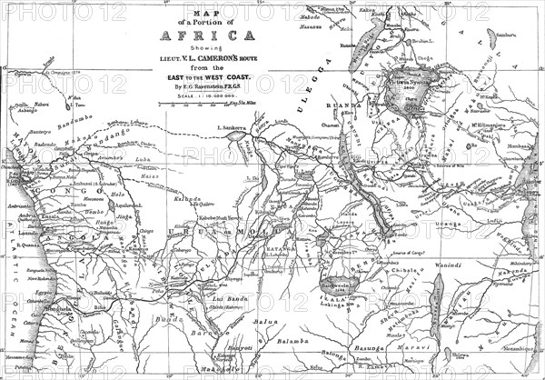
Map of a Portion of Africa, showing...Cameron's Route from the East to the West Coast...1876. Creator: Ernst Ravenstein.
Caption
Map of a Portion of Africa, showing Lieut. V.L. Cameron's Route from the East to the West Coast, 1876. 'A Map of the entire width of Africa, from the Indian Ocean to the Atlantic...It shows completely the African lake-region, one of the most remarkable geographical features in the world...Cameron has navigated one of these lakes, the Tanganyika, which Burton and Speke were the first to reach from the east coast, and the northern portions of it were navigated by Livingstone and Stanley. He has shown, moreover, that this Tanganyika discharges a river towards the west, and has thereby settled the vexed question of its connection with the Nile...Cameron has shown that the Tanganyika, and all the rivers which enter it, drain towards the west, into a river of mighty proportions; and there can be little doubt of this latter being the upper Congo [River]...'. From "Illustrated London News", 1876.
Credit line
Photo12/Heritage Images/The Print Collector
Reference
HRM23A81_237
Model release
NA
Property release
NA
License type
Droits gérés
Available size
54.3Mo (2.3Mo) / 44.2cm x 30.8cm / 5219 x 3639 (300dpi)