Title
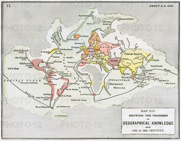
Map XIV showing the progress of Geographical Knowledge from 14th to 19th Century
Caption
Map XIV showing the progress of Geographical Knowledge from 14th to 19th Century, Illustration, Ridpath's History of the World, Volume III, by John Clark Ridpath, LL. D., Merrill & Baker Publishers, New York, 1897
Date
1897
Credit line
Photo12/Glasshouse Images/JT Vintage Vintage
Reference
GLS20A04_054
Model release
NA
Property release
NA
License type
Rights managed
Available size
50.7Mb (5.3Mb) / 15.9in x 12.4in / 4770 x 3715 (300dpi)