Same subject
Nativesusa12
Title
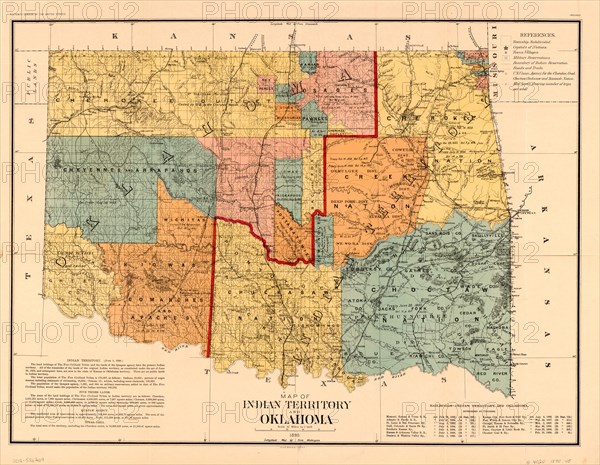
Map of Indian Territory and Oklahoma
Caption
Map of Indian Territory and Oklahoma, U.S. Bureau of the Census, 1890
Date
Jan 06, 1890
Credit line
Glasshouse Images/Photo12/Circa Images
Reference
GLS20A02_306
Model release
NA
Property release
NA
License type
Rights managed
Available size
50.1Mb (6.7Mb) / 15.8in x 12.3in / 4748 x 3685 (300dpi)