Title
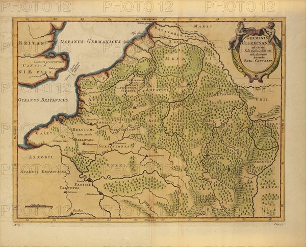
Germaniae Cisrhenanae ut Circa Julii Caesaris Suit Aetatem, Descriptio, Map of German Empire to West of the Rhine River, into Belgium and France, during the time of Julius Caesar, by German Geographer Philipp Clüver, Published in Germaniae Antiquae Libri Tres, 1631
Caption
Germaniae Cisrhenanae ut Circa Julii Caesaris Suit Aetatem, Descriptio, Map of German Empire to West of the Rhine River, into Belgium and France, during the time of Julius Caesar, by German Geographer Philipp Clüver, Published in Germaniae Antiquae Libri Tres, 1631
Date
Jan 06, 1631
Credit line
Glasshouse Images/Photo12
Reference
GLS18A29_061
Model release
No
License type
Rights managed
Available size
47.9Mb (3.0Mb) / 15.2in x 12.3in / 4553 x 3676 (300dpi)