Title
Nautical Atlas
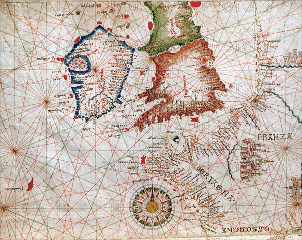
Caption
Giovanni Xenodocos da Corfu
Nautical Atlas in 6 maps. Maps 1 and 2: Atlantic coast of Europe, Iberian Peninsula, Balearics, North-Western African coast, Canary Islands, Mediterranean Sea
Detail: Ireland, England, Scotland, Brittany
Dimensions: 32 x 22.5 cm
Date 24 September 1520
Venice, Museum Correr.
Date
Sep 24, 1520
Credit line
Alfredo Dagli Orti/Photo12
Reference
DGL15A00_130
License type
Rights managed
Available size
149.8Mb (10.1Mb) / 27.1in x 21.5in / 8118 x 6449 (300dpi)