Title
Nautical Atlas
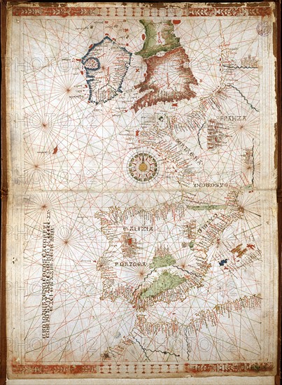
Caption
Giovanni Xenodocos da Corfu
Nautical Atlas in 6 maps. Maps 1 and 2: Atlantic Coast of Europe, Iberian Peninsula, Balearics, North-Western African Coast, Canary Islands, Mediterranean Sea
Dimensions: 32 x 22.5 cm
Date 24 September 1520
Venice, Correr Museum.
Date
Sep 24, 1520
Credit line
Alfredo Dagli Orti/Photo12
Reference
DGL15A00_129
License type
Rights managed
Available size
129.2Mb (8.5Mb) / 19.2in x 26.2in / 5756 x 7845 (300dpi)