Title
Map of Oise, Argonne, Nancy and the Swiss border
Caption
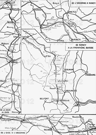
First World War.
Map of the estimated front line of the armies, 15th January 1914 according to the statement on 21st January 1914.
Info+
The lines above are the scale
Plots above are the scale of the map in four sheets published in L'Illustration, 19th and 26th December 1914, 2nd and 9th January 1915.
Date
Jan 15, 1914
Credit line
Photo12/Archives Snark
Reference
DFS12A00_196
License type
Rights managed
Available size
44.4Mb (1.6Mb) / 11.1in x 15.5in / 3336 x 4647 (300dpi)