logo photo12.com logo photo12.com PHOTOGRAPHIC AGENCY
  • Photographers
  • Collections
  • Topics
  • Contact
  • My account
0
  • EN
    • Français
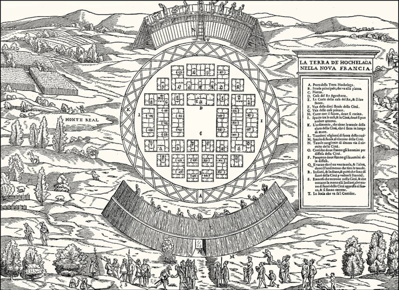
Map of Hochelaga, a St. Lawrence Iroquoian 16th century fortified village, near Mount Royal in present-day Montreal, Quebec, Canada
Caption

Map of Hochelaga, a St. Lawrence Iroquoian 16th century fortified village, near Mount Royal in present-day Montreal, Quebec, Canada

Credit line

Photo12/ImageBROKER/Heinz-Dieter Falkenstein

Reference

BRK26J81_199

Model release

No

Property release

No

License type

Rights managed

Available size

65.9Mb (22.0Mb) / 18.7in x 13.7in / 5622 x 4096 (300dpi)

Keywords

detail close up deserted church building sacral building village history orientation territory Quebec Province Canada North America America illustration depiction map information historic Canadian Middle Ages medieval secured plan Quebec City Montreal Mount Royal St. Lorenz 16th century detail view Historic illustration Fortified Cartography section close-up no one structure sacred building navigation Province of Quebec representation town historical In the middle ages mediaeval Quebec Montréal Lorenzkirche sixteenth century Historical illustration closeup No People construction religious building place Québec Mont Royal St. Lawrence the 1500s Close view nobody Church building spot 16th c. close shot uninhabited empty details close ups churches buildings villages territories illustrations depictions maps plans Historic illustrations sections close-ups historically Historical illustrations closeups constructions religious buildings Detailed image Close-up Kirche depicting historical image history image history images detailed view close-up shot representing

Please log in to download the high resolution file
Pic
  • Contact
  • Partners
  • Terms and Conditions
  • Legal mentions
  • About us
  • FNAPPI member