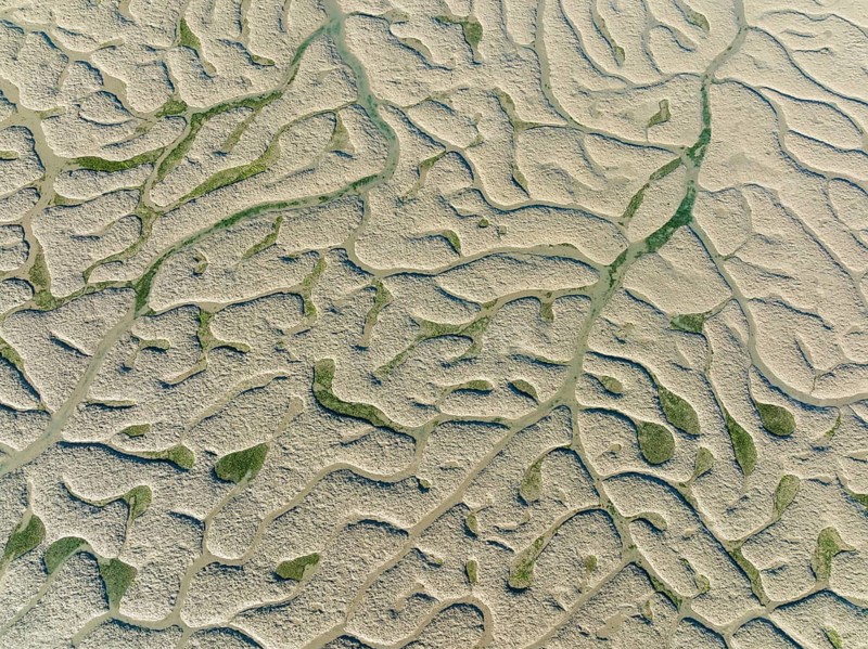
Network of dry channels and streams at low tide, in the marshland of the Bahía de Cádiz, aerial view, drone shot, Cádiz province, Andalusia, Spain
Caption

Network of dry channels and streams at low tide, in the marshland of the Bahía de Cádiz, aerial view, drone shot, Cádiz province, Andalusia, Spain

Date

May 16, 2022

Credit line

Photo12/ImageBROKER/Thomas Dressler

Reference

BRK26J80_104

Model release

NA

Property release

No

License type

Royalty free

Available size

54.4Mb (18.1Mb) / 16.8in x 12.6in / 5039 x 3774 (300dpi)

Keywords

View from above deserted daytime music network online Boat trip drought river low tide tide wetland meadow salty biotope bird reserve nature Spain Europe photography swamp Spanish natural preserve digital reserve structure dry Aerial waterway pattern horizontal landscape channel view Southern Europe service full frame nature reserve reservation low salt marsh creep winding Andalusia low water looking down ecosystem bird conservation wet meadow service provider travel photography Costa de la Luz outdoors natural environment streaming service swampy Cadiz provinz drone photography background image Tidal music streaming Waterway Bird sanctuary Natural pattern high-angle view no one on-line dryness wet land lawn salt open air marshland nature park protected area arid aerial photography canal scenery overlook South Europe full-frame meander curling Andalucia Low tide view down ecological system bird protection outside habitat streaming boggy Cádiz province drone image nature pattern top down view No People day wetland biotope field marsh area Naturpark sanctuary water canal countryside facing filling the picture nature conservation area natural habitat muddy Province of Cádiz background graphic nobody daylight marsh conservation area landscape shot view into full image natural reserve marshy Provincia de Cádiz wallpaper uninhabited landscape photo view over format-filling environmental reserve empty full size Overlook Image-filling overview filling the format full-format image elevated view networks Boat trips droughts rivers low tides tides wetlands meadows biotopes bird reserves swamps natural preserves digitally reserves structures Aerials aerial view aerial shot waterways patterns horizontally landscapes view of View of services nature reserves reservations salt marshes creeping ecosystems wet meadows service providers natural environments Natural patterns high-angle shot marshlands airshot canals sceneries outlook meandering drone shot photo with drone nature patterns marsh areas water canals bird's eye view marshes Overlooking overviews from above overhead Grass field Europe's aerial photo aerial photos designs landscape photograph NSG creeps outdoor out open sky with a drone from a drone aerial drone top view top views Top angle natural park Aerial landscape aerial photograph drone photograph drone recording top down flight photo flight photos flight shot flight shots from the sky from the air winds drone photo drone photos drone view birds eyes view Bird eye view bird view bird perspective

Please log in to download the high resolution file