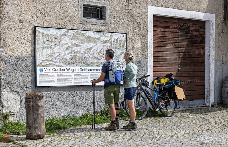
Two hikers are standing in front of a wall map at the top of the Gotthard Pass. The mountain pass connects the villages of Andermatt in the canton of Uri with Airolo in the canton of Tessin. The pass is at an altitude of 2107 meters above sea level. Airolo, Canton of Tessin, Switzerland
Caption

Two hikers are standing in front of a wall map at the top of the Gotthard Pass. The mountain pass connects the villages of Andermatt in the canton of Uri with Airolo in the canton of Tessin. The pass is at an altitude of 2107 meters above sea level. Airolo, Canton of Tessin, Switzerland

Date

Aug 30, 2026

Credit line

Photo12/ImageBROKER/Arnulf Hettrich

Reference

BRK26J40_005

Model release

No

Property release

No

License type

Rights managed

Available size

80.2Mb (26.7Mb) / 21.9in x 14.2in / 6583 x 4258 (300dpi)

Keywords

panorama meter geography leisure Hiker hike drive curve serpentine road traffic transport traffic traffic route map two Alps Mountain Range nature Switzerland St Gotthard Pass holiday panorama view Europe tourism village mountain range tourist attraction alpine natural observation point on the way mountainous road sightseeing height winding landscape view infrastructure recreational activity activity holiday connection european holiday time Canton Graubünden bend transit connect mountain mountain pass exterior view sea love of nature close to nature pass pass summit elevation mountain road experience of nature Ticino nature tourism townscape seminatural Western Alps travel photography hairpin bend Mountain pass of the Alps Canton of Uri Canton of Ticino Swiss Alps Swiss hiking map outdoors mountain panorama natural environment Central Europe holidays mountainscape Pass road Mountain view Sea level Alpine hiking panoramic view metre recreation hiking switchback road transport transportation 2 open air Gotthard Pass vacation wander through town range place of interest high alpine original viewing point en route street altitude curvy scenery ride overlook connector vacation time Canton of Graubünden curvature exterior touch with nature top of the pass nature vacation local view semi-natural hairpin curve Uri Trekking map outside panorama of mountains natural surrounding Middle Europe alpine landscape Mountain pass road panoramic image free time street traffic place mountain chain Famous Place high-alpine viewpoint on their way countryside facing Graubünden bending outdoor shot closeness to nature pass summit nature holidays view of the village hairpin turn Canton Uri Canton Ticino mountains panorama mountain scenery panorama shot spot ridge vantage point on the road landscape photo view into Grisons exterior photograph town view near-natural mountainous region panoramic point of view heading view over Canton Grisons outdoor photo Overview of the town mountainous landscape scenic view look out on route mountain landscape Overlook mountain backdrop overview mountainous area Bergland panoramas meters Hikers hikes driving curves serpentines transports traffic routes maps mountain ranges tourist attractions observation points roads sightseeing tours heights landscapes drives view of View of infrastructures recreational activities activity holidays connections bends transits connecting mountains mountain passes exterior views passes pass summit elevations mountain roads townscapes hairpin bends Mountain passes of the Alps hiking maps Pass roads metres switchbacks vacations ranges places of interest originally viewing points streets curved sceneries rides outlook connectors Mountain pass roads panoramic images Famous Places viewpoints on his way on her way outdoor shots panoramic shot vantage points exterior photographs outdoor photos mountain landscapes Overlooking overviews mountainous areas walker walkers on a trail trek travels turn turns Serpentine curve Mountains Europe's walk walks sight landmark tourist landmark Straße connexion connexions connects Mount Mt. Mont Mt outdoor out open sky road pass Mountains view hiking tour tourist spot landscape photograph landscape shot

Please log in to download the high resolution file