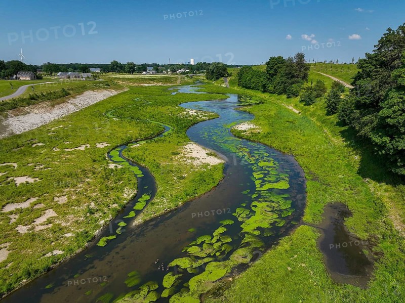
Castrop-Rauxel, Recklinghausen, North Rhine-Westphalia, Germany, EMSCHERLAND adventure park at the Emscher-RHK water crossroads. EMSCHERLAND, a water and nature adventure park covering around 30 hectares at the water crossroads of the Rhine-Herne Canal and the renaturalised Emscher (centre) on the border between Recklinghausen and Castrop-Rauxel. The ecological focus at the confluence of Suderwicher Bach (left) and Emscher (centre) will also be a future garden for the International Garden Exhibition 2027. Before the renaturation, the Emscher river system was an open, above-ground wastewater channel, a combined sewer with surface water and wastewater. Where the Emscher, the Suderwicher Bach and the Rhine-Herne Canal meet, an inter-municipal adventure park has been created in recent years on an area of around 30 hectares. The park's facilities include a water playground, a water learning centre, a perennial garden, a beekeeper's house, a meadow orchard and buildings
Caption

Castrop-Rauxel, Recklinghausen, North Rhine-Westphalia, Germany, EMSCHERLAND adventure park at the Emscher-RHK water crossroads. EMSCHERLAND, a water and nature adventure park covering around 30 hectares at the water crossroads of the Rhine-Herne Canal and the renaturalised Emscher (centre) on the border between Recklinghausen and Castrop-Rauxel. The ecological focus at the confluence of Suderwicher Bach (left) and Emscher (centre) will also be a future garden for the International Garden Exhibition 2027. Before the renaturation, the Emscher river system was an open, above-ground wastewater channel, a combined sewer with surface water and wastewater. Where the Emscher, the Suderwicher Bach and the Rhine-Herne Canal meet, an inter-municipal adventure park has been created in recent years on an area of around 30 hectares. The park's facilities include a water playground, a water learning centre, a perennial garden, a beekeeper's house, a meadow orchard and buildings

Date

Jun 09, 2023

Credit line

Photo12/ImageBROKER/Rupert Oberhäuser

Reference

BRK26G47_416

Model release

NA

Property release

No

License type

Rights managed

Available size

59.8Mb (19.9Mb) / 17.6in x 13.2in / 5280 x 3956 (300dpi)

Keywords

horizon View from above deserted modification house border vegetation gardens wetland climate meadow distance biotope environment protection ecological Recklinghausen Rhine-Herne-Canal Ruhr district North Rhine-Westphalia German flora Europe natural preserve reserve climate protection riverbed Aerial global commercial area ecofriendly ecology infrastructure european renaturation industrial area nature reserve River landscape organic Germany flood control project looking down seminatural landscape conservation renaturated Castrop-Rauxel Emscher river course natural environment wetland landscape Central Europe drone photography meadow landscape Industry landscape country Herbaceous Garden floodplain River system Surface water wastewater-free City boundary Emscherland Emscher conversion high-angle view no one alteration home frontier park wet land lawn environmental protection Rhine-Herne Canal Ruhr area NRW plant life nature park protected area climate control river bed aerial photography worldwide industrial estate eco-friendly industrial zone riverine landscape German Federal Republic flood protection view down semi-natural landscape preservation renaturalised course of a river natural surrounding Middle Europe drone image grassland landscape Industrial landscape perennial garden flood plain top down view No People conversion border station wetland biotope field environmental conservation Ruhr Federal State of North Rhine-Westphalia Naturpark sanctuary world-wide environmentally friendly Industrial district nature conservation area river scenery Republic of Germany flood prevention close to nature landscape protection nobody boundary Ruhr region North-Rhine Westphalia conservation area Environmental friendly natural reserve Riverscape FRG near-natural uninhabited Ruhrgebiet environmental reserve empty horizons elevated view modifications houses borders vegetations wetlands climates meadows distances biotopes ecologically natural preserves reserves riverbeds Aerials aerial view aerial shot commercial areas infrastructures industrial areas nature reserves River landscapes projects countries floodplains high-angle shot homes parks airshot industrial zones riverine landscapes drone shot photo with drone river sceneries bird's eye view BRD from above overhead Grass field Europe's aerial photo aerial photos industrial park industrial parks NSG River view flood water control with a drone from a drone aerial drone top view top views Top angle natural park Aerial landscape aerial photograph course of the river drone photograph drone recording top down flight photo flight photos flight shot flight shots from the sky from the air drone photo drone photos drone view birds eyes view Bird eye view bird view bird perspective

Please log in to download the high resolution file