logo photo12.com logo photo12.com PHOTOGRAPHIC AGENCY
  • Photographers
  • Collections
  • Topics
  • Contact
  • My account
0
  • EN
    • Français
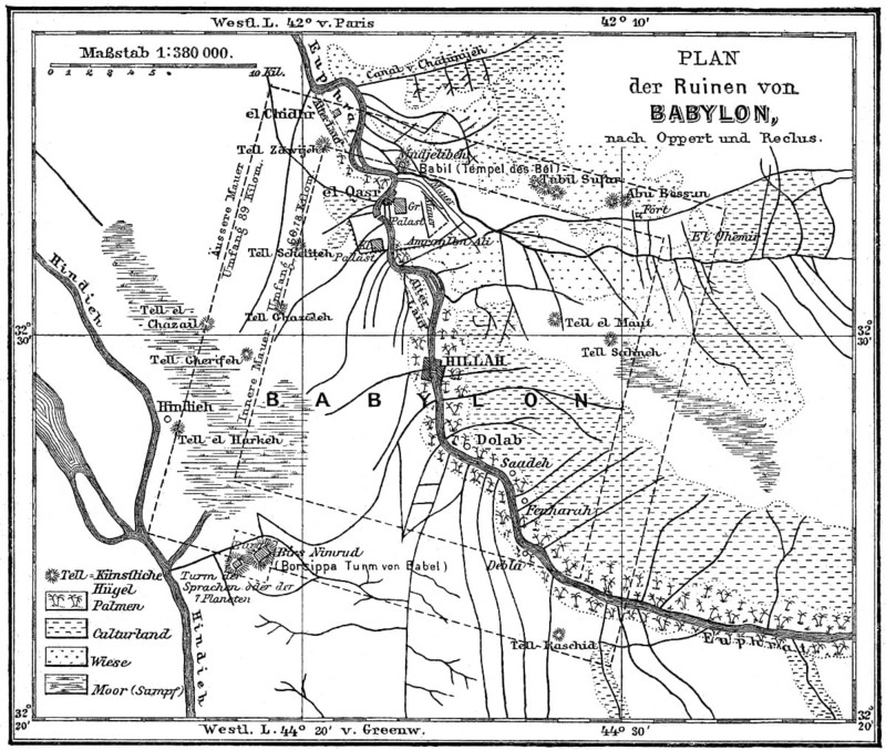
Map of the Babylonian Ruins, 19th century
Caption

Map of the Babylonian Ruins, 19th century

Date

Jul 04, 2020

Credit line

Photo12/ImageBROKER/Heinz-Dieter Falkenstein

Reference

BRK26D74_232

Model release

No

Property release

No

License type

Rights managed

Available size

70.1Mb (23.4Mb) / 17.9in x 15.2in / 5380 x 4555 (300dpi)

Keywords

detail close up deserted ruin building geography antiquity history orientation Mediterranean Sea map decayed historic culture rundown cultural old heritage geographic sea plan ancient civilization Mesopotamia detail view 19th century Levant Assyrian section close-up no one Ruined building structure ancient world navigation Mediterranean ruined ancient times historical deteriorated geographical nineteenth century Orient closeup No People construction run-down 1900s Close view nobody dilapidated close shot uninhabited falling apart empty details close ups ruins buildings maps Altertum cultures heritages plans ancient civilizations 19th-century sections close-ups Ruined buildings historically closeups constructions Detailed image Close-up historical image history image history images oldest detailed view close-up shot marooned ramshackle derelict

Please log in to download the high resolution file
Pic
  • Contact
  • Partners
  • Terms and Conditions
  • Legal mentions
  • About us
  • FNAPPI member