Caption
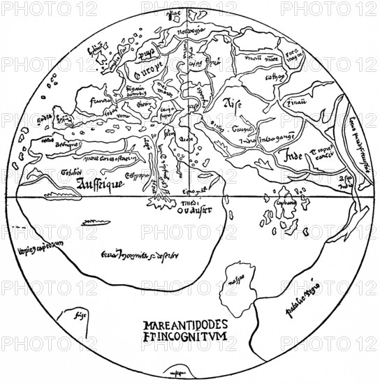
World map from the 15th century, earth with the then known or unknown parts of the world, Mare Antipodes and Terra Incognita, polar region, Asia, Europe with Francia, France, Africa, India, Nile, Danube, Mediterranean, historical illustration 19th century
Date
Jan 05, 2026
Credit line
Photo12/imageBROKER/Wolfgang Diederich
Reference
BRK26A75_381
Model release
No
Property release
No
License type
Rights managed
Available size
62.0Mb (2.0Mb) / 15.4in x 15.6in / 4630 x 4681 (300dpi)