Caption
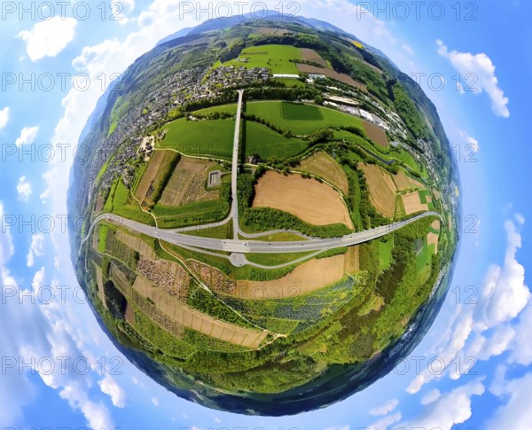
Aerial view, motorway A46 junction Bestwig with view of Velmede, shapes and colours, meadows and fields with tree plantations, globe, fisheye image, fisheye image, 360 degree image, tiny world, little planet, fisheye image, Velmede, Bestwig, Sauerland, North Rhine-Westphalia, Germany, motorway A46, junction Bestwig, shapes, colours, meadows, fields, tree plantations, panorama, infrastructure, landscape, nature, traffic, road network, rural, environment, perspective, view from above, village, scenery, way?, sky, top view
Date
08 mai 2024
Credit line
Photo12/imageBROKER/Hans Blossey
Reference
BRK25I56_298
Model release
Non
Property release
Non
License type
Droits gérés
Available size
231.5Mo (11.5Mo) / 84.7cm x 68.5cm / 9999 x 8094 (300dpi)