Caption
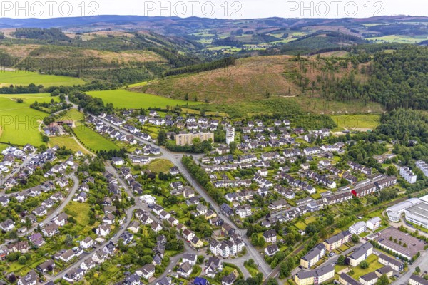
Aerial view, high-rise buildings and housing estate on Brandenburger Straße, forest area with forest damage and distant view, Bad Berleburg, Wittgensteiner Land, North Rhine-Westphalia, Germany, architecture, Brandenburger Straße, trees, drone image, distant view, forestry, buildings, high-rise buildings, real estate, infrastructure, landscape, nature, panorama, damage, settlement, city, urban development, environment, urban, forest area, forest damage, housing estate, flats, rural
Date
Jul 07, 2024
Credit line
Photo12/imageBROKER/Hans Blossey
Reference
BRK25I54_107
Model release
No
Property release
No
License type
Rights managed
Available size
146.4Mb (15.7Mb) / 29.2in x 19.5in / 8760 x 5843 (300dpi)