Title
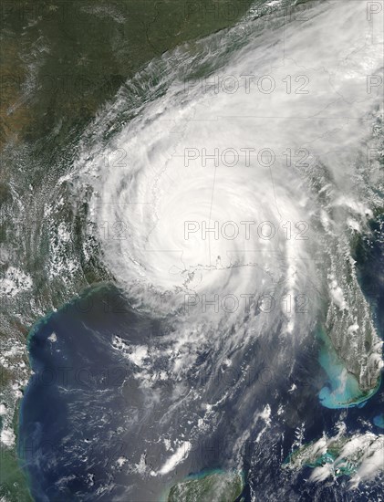
Hurricane Katrina was sprawled across all or part of 16 states at 2:15 p.m. CDT on August 29
Caption
Hurricane Katrina was sprawled across all or part of 16 states at 2:15 p.m. CDT on August 29, 2005, when the Moderate Resolution Imaging Spectroradiometer (MODIS) on NASAOs Aqua satellite captured this image. After nearly eight hours over land, Katrina was still a Category 1 storm, with winds of 150 kilometers per hour (95 miles per hour) and stronger gusts. In this image, Katrina measures about 1, 260 kilometers (780 miles) from east to west and about the same distance from north to south across its cente
Credit line
Photo12/imageBROKER/Phil Degginger
Reference
BRK22I30_148
Model release
No
Property release
NA
License type
Rights managed
Available size
48.4Mb (2.9Mb) / 12.0in x 15.7in / 3600 x 4700 (300dpi)