Title
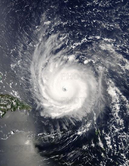
Hurricane Frances
Caption
Hurricane Frances, the MODIS instrument aboard NASA's Aqua satellite captured this true-color image of Hurricane Frances on August 31, 2004 at 17:55 UTC (1:55 PM EDT) . At the time this image was taken Frances was located approximately 230 km (140 miles) north-northeast of San Juan, Puerto Rico and was moving towards the west near 26 km/hr (16 mph) . Maximum sustained winds were near 225 km/hr (140 mph) and the storm's minimum central pressure was down to 942 millibars
Credit line
Photo12/imageBROKER/Phil Degginger
Reference
BRK22I30_145
Model release
No
Property release
NA
License type
Rights managed
Available size
28.8Mb (2.0Mb) / 9.3in x 12.0in / 2800 x 3600 (300dpi)