Drone shot
Title

Drone shot

Caption

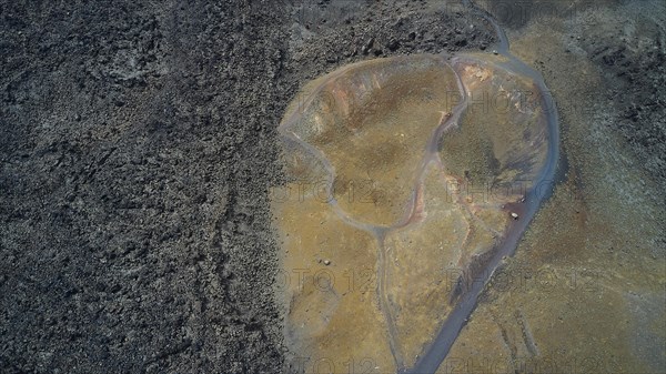
Drone shot, volcanic landscape, paths, volcanic island of Nea Kameni, caldera, Santorini Island, Cyclades, Greece, Europe

Date

May 01, 2021

Credit line

Photo12/imageBROKER/Ralf Adler

Reference

BRK22C10_361

Model release

NA

Property release

NA

License type

Royalty free

Available size

50,0Mb (4,2Mb) / 18,6in x 10,4in / 5578 x 3134 (300dpi)

Keywords

Aegean Aegean Sea Aerial Caldeira Cyclades Cyclades islands Europe Europe's Greece Greek island Greek islands High Angle View Mediterranean Mediterranean area Mediterranean region No People Overlook Santorin Santorini Southeast Europe Southeastern Europe View from above Volcan Volcano aerial photo aerial photograph aerial photography aerial photos aerial shot aerial view barrenness bird's eye view birds-eyes-view boiler caldera calderas countryside craggy crater craters deserted drone image drone photo drone photography drone shot drone shots drone view elevated view empty facing flight photo flight shot from a drone from above from the air high-angle shot high-angle view holiday region holiday regions holiday vacation destination island islands jagged kettle kettles landscape landscape photo landscape shot landscapes looking down mediterranean mountain mountain peak mountain top mountainous mountains mountaintop nature no one nobody overhead overlook overview path peak peaks pinnacle rugged rutted scenery summit top top down top down view top view top-down view topview travel destination travel photography uninhabited vacation region view view down view down to the bottom view into view of, View of view over volcanic volcanic area volcanic areas volcanic island volcanic islands volcanic landscape volcanic landscapes volcanic mountain volcanism volcano landscape volcano mountain volcanoes way ways Balkan Balkan Peninsula Balkans Greek South Europe Southern Europe barren desolate meager meagre sparse

Please log in to download the high resolution file