Title
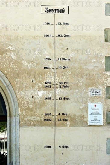
High water chart with water levels of the Danube over six centuries
Caption
High water chart with water levels of the Danube over six centuries, Town Hall, historic centre, Passau, Lower Bavaria, Bavaria, Germany, Europe
Date
Aug 01, 2014
Credit line
Photo12/imageBROKER/Raimund Kutter
Reference
BRK19I14_122
Model release
No
License type
Royalty free
Available size
50.1Mb (2.4Mb) / 11.4in x 17.1in / 3412 x 5128 (300dpi)