Title
Portuguese map, known as Cantino map, 16th century
Caption
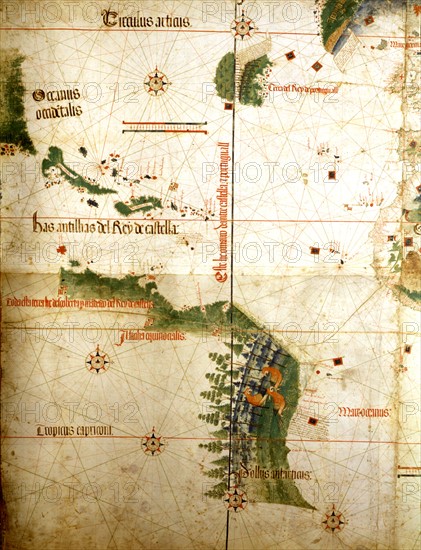
Portuguese map, known as Cantino map, indicating the limiting line between Spanish and Portuguese territories, set by the treaty of Tordesillas (June 7, 1494)
c.1502
Modena - Biblioteca Estense
Date
1502
Credit line
Photo12
Reference
ASI01316_H131107
Model release
No
License type
Rights managed
Available size
24.9Mb (1.4Mb) / 8.6in x 11.2in / 2583 x 3367 (300dpi)