Title
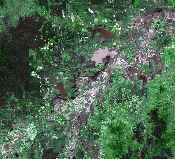
Satellite view of the inundation west of Brisbane in Australia
Caption
Image of the inundation west of Brisbane, Queensland, Australia. Torrential rains in northeastern Australia caused the Brisbane River to overflow its banks and flood much of the surrounding agricultural lands and small towns in the flood plain. January 17, 2011. Satellite image.
Date
20th century
Credit line
Photo12/Ann Ronan Picture Library
Reference
ARP15A06_161
License type
Rights managed
Available size
50.0Mb (4.0Mb) / 14.6in x 13.3in / 4394 x 3977 (300dpi)