302 résultats pour : geographical
- Page
-
- sur
- 4
Connectez-vous pour plus de résultats
LZT20A28_170
The Cañon of Kanab Creek, near its junction with t...
LZT20A28_171
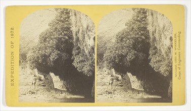
The Bath, a dripping spring in Kanab Cañon. Temper...
LZT20A28_129
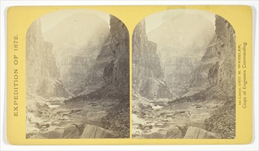
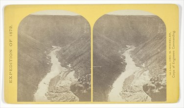
View in the Grand Cañon of the Colorado River, 187...
LZT20A28_172
The mouth of Kanab Creek. The beds of the Colorado...
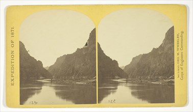
LZT20A28_128
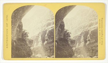
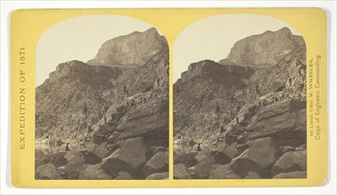
View across Black Cañon. The grand walls in perspe...
LZT20A28_173
Mouth of the Paria, Colorado River, walls 2.100 fe...
LZT20A28_138
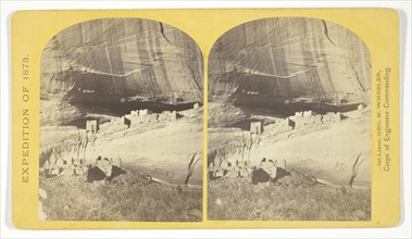
Circle Walls, Cañon de Chelle. Here the Cañon bend...
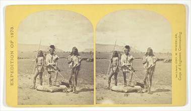
LZT20A28_149
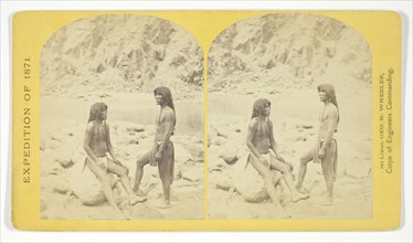
Apache Indians, as they appear ready for the war-p...
LZT20A28_139
View down Black Cañon, from Mirror Bar. The walls ...
LZT20A28_148
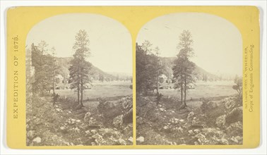
Cooley’s Ranch, 10 miles east of Camp Apache, Ariz...
LZT20A28_158
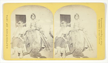
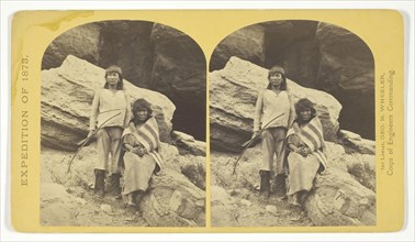
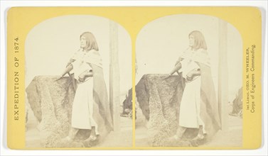
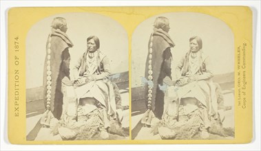
Jicarilla Apache Brave and Squaw, lately wedded. A...
LZT20A28_169
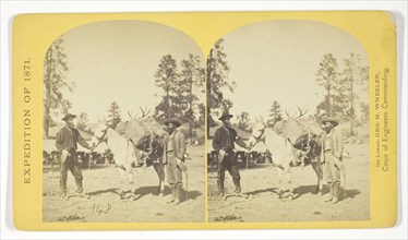
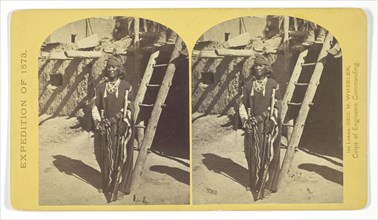
Mountain transportation. Pack mule, Pack and Packe...
LZT20A28_159
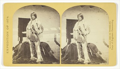
Shee-zah-nan-tan, Jicarilla Apache Brave in charac...
LZT20A28_168
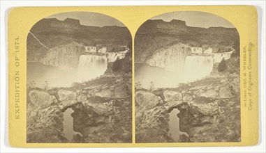
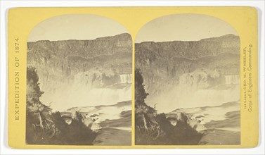
Shoshone Falls, Snake River, Idaho. Gorge and natu...
LZT20A28_134
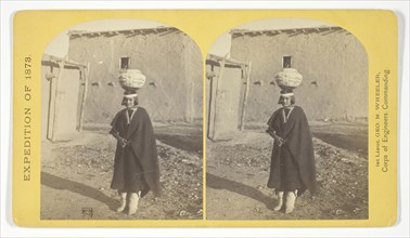
Zuni Indian Girl, with water olla, 1873, Timothy O...
LZT20A28_145
Navajo Brave and his Mother. The Navajo were forme...
LZT20A28_156
Pah-ge, a Ute Squaw, of the Kah-poh-teh band, Nort...
LZT20A28_167
Shoshone Falls, Snake River, Idaho, looking throug...
LZT20A28_135
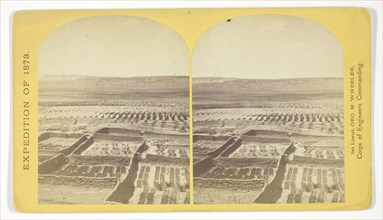
Gardens surrounding the Indian Pueblo of Zuni, in ...
LZT20A28_144
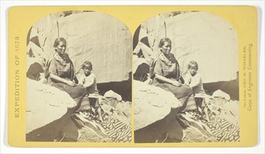
Navajo Indian Squaw, and Child, at their home, in ...
LZT20A28_157
Ute Braves, of the Kah-poh-teh band, Northern New ...
LZT20A28_166
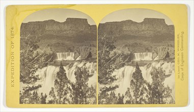
Shoshone Falls, Snake River, Idaho, Main Fall, 210...
LZT20A28_136
War Chief of the Zuni Indians, 1873, Timothy O’Sul...

LZT20A28_147
Coyotero Apache Scouts, at Apache Lake, Sierra Bla...

LZT20A28_154
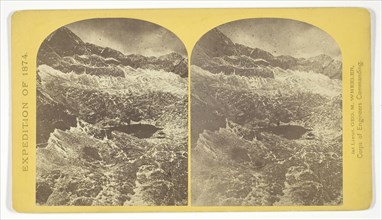
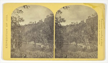
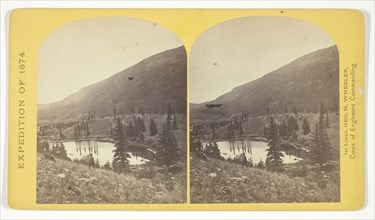
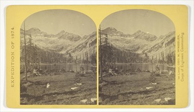
Lost Lakes, head of Conejos Cañon, Colorado, in th...
LZT20A28_165
Alpine lakes, and mountain scenery, in the Cerro B...
LZT20A28_137
Ruins in Cañon de Chelle, N. M., in a cavity in th...
LZT20A28_146
Apache Lake, Summit of Sierra Blanca Mountains, ab...
LZT20A28_155
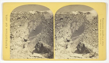
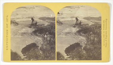
One of the group of Pagosa Hot Springs, showing in...
LZT20A28_164
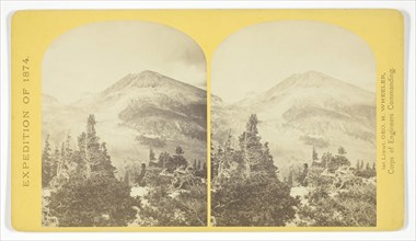
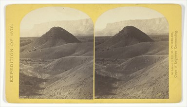
Baldy Peak, Cerro Blanco Mountains, Colorado, 14.2...
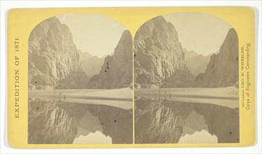
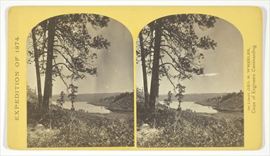
LZT20A28_127
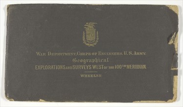
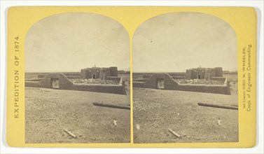
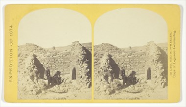
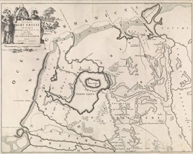
Geographical Explorations and Surveys West of the ...
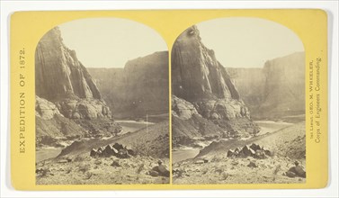
LZT20A28_130
Marble Cañon, one of the gorges of the Colorado he...
LZT20A28_141
Central portion of Canñon de Chelle, New Mexico. T...
LZT20A28_152
Beaver Lake, Conejos Cañon, Colorado, 9.000 feet a...
LZT20A28_163
Alpine Lake, in the Cerro Blanco Mountains, Colora...
LZT20A28_131
The northern wall of the Grand Cañon of the Colora...
LZT20A28_140
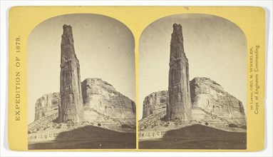
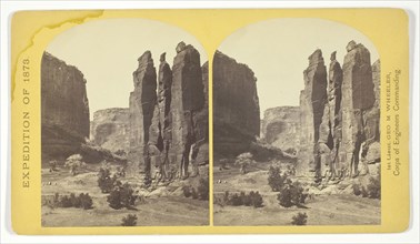
Explorers Column, Cañon de Chelle, Arizona. This s...
LZT20A28_153
Cañon, Valley of the Conejos River, looking south ...
LZT20A28_162
Lagunas Caballo, or Horse Lakes, 14 miles, N. W. f...
LZT20A28_132
The Vermillion Cliff, a typical plateau edge, as s...
LZT20A14_187
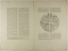
The Geographical Atlas of Ptolemy, 1889, Unknown A...
LZT20A28_143
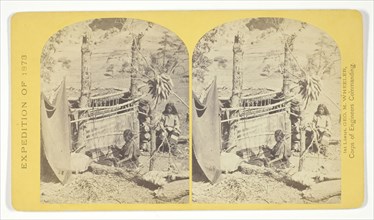
Aboriginal life among the Navajo Indians, Cañon de...
LZT20A28_150
Types of Mojave Indians. This tribe inhabits the r...
LZT20A28_161
View of Grand Cañon walls, near mouth of Diamond R...
LZT20A28_133
Indian Pueblo of Zuni, New Mexico, view from the i...
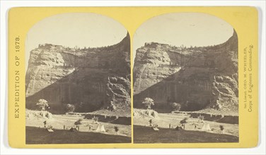
LZT20A28_142
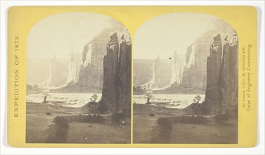
Camp Beauty, Canñon de Chelle, walls 1.200 feet hi...
LZT20A28_151
Roman Catholic Church, Plaza of Guadaloupe, Guadal...
LZT20A28_160
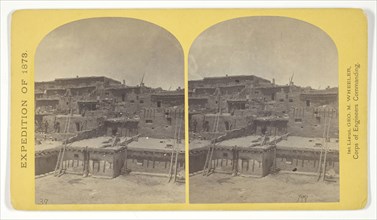
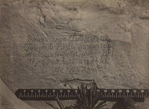
Characteristic ruin, of the Pueblo San Juan, New M...
LZT19B45_290
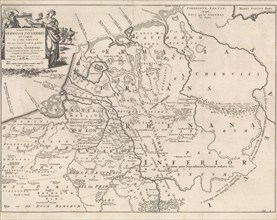
Bohn, François, KAMPEN, N.G. FROM. State and geogr...
LZT19B36_249
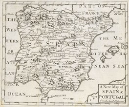
A new map of Spain and Portugal, from the latest o...
LZT19A74_112
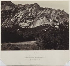
Geographical & Geological Explorations and Surveys...
LZT19A76_089
King Survey (series from a geographical survey of ...
LZT16A24_167
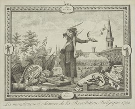
Allegory of the Brabant Revolution, 1791, Anonymou...
LZT16A27_338
Sea chart of part of the coast of Brazil, Jan Luyk...
LZT16A28_346
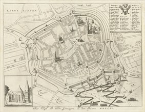
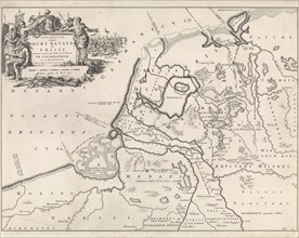
Map of Groningen during the siege, 1594, The Nethe...
LZT16A27_412
Sea chart of part of the coast of the Kola peninsu...
LZT16A27_430
Sea chart of the Danish Islands, part of the coast...
LZT16A27_439
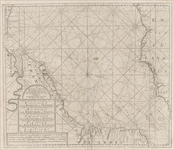
Sea chart of the Baltic and North Sea, Jan Luyken,...
LZT16A25_273
Map of estate Gunterstein, Breukelen, Joseph Mulde...
LZT16A27_349
Sea chart of the southern part of the Atlantic coa...
LZT16A27_385
Sea chart of part of the coast of Brittany, Anonym...
LZT16A27_394
Sea chart of part of the south coast of Brittany, ...
LZT16A27_403
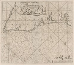
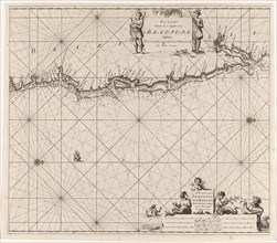
Sea chart of the coast of Ireland, Scotland, Engla...
LZT16A27_421
Sea chart of the southern part of the Baltic Sea, ...
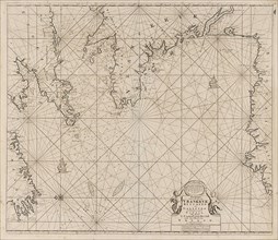
LZT16A27_448
Sea chart of the coasts of England, Scotland and I...
LZT16A29_387
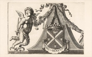
Coat of arms of Michiel ten Hove, Romeyn de Hooghe...
LZT16A27_339
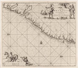
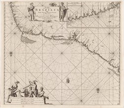
Sea chart of part of the east coast of Brazil, pri...
LZT16A32_105
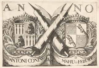
Coat of arms of Antoni Coning (mayor of Haarlem?) ...
LZT16A27_413
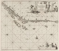
Sea chart of part of the coast of Finnmark, Jan Lu...
LZT16A27_431
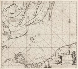
Sea chart of Denmark in the Skagerrak and Kattegat...
LZT16A31_437
Historical map of Netherlands with the areas of th...
LZT16A27_348
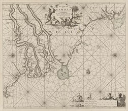
Sea chart of the coast of Gambia and part of the c...
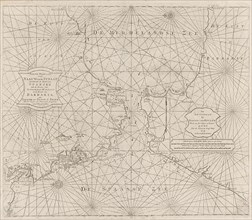
LZT16A27_384
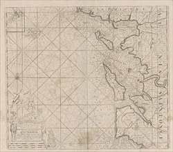
Sea map of part of the south coast of Portugal and...
LZT16A27_395
Map of the west coast of Brittany, Anonymous, Clae...
LZT16A27_402
Sea chart of the Channel between England and Franc...
LZT16A27_420
Sea chart of the northwestern part of the Baltic S...
LZT16A27_449
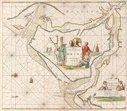
Sea chart of the Northern Dvina River, Jan Luyken,...
LZT16A27_340
Sea chart of the east coast of Brazil, Jan Luyken,...
LZT16A32_101
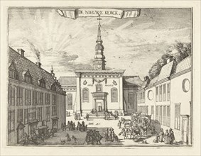
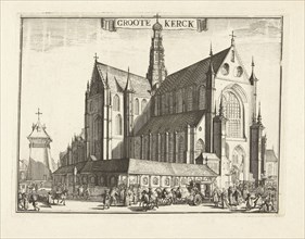
View of the New Church in Haarlem, The Netherlands...
LZT16A27_414
Sea chart of part of the Norwegian coast, Norway, ...
LZT16A27_441
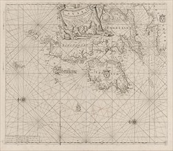
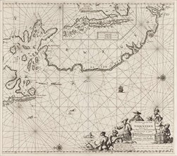
Sea chart of part of the coast of Ireland, England...
LZT16A31_376
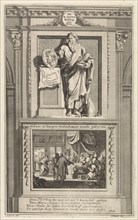
H. Titus, Jan Luyken, Zacharias Chatelain (II), Fr...
LZT16A31_438
Historical map of the Netherlands at the time of t...
LZT16A27_351
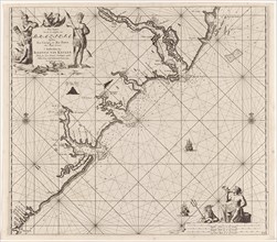
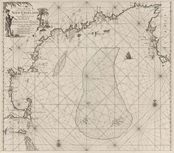
Sea chart of part of the east coast of the United ...
LZT16A27_383
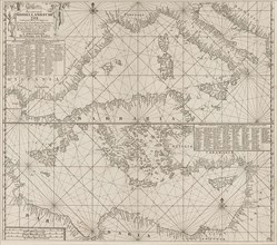
the Mediterranean Sea Map with over the western an...
LZT16A27_392
Sea chart of Saintonge and Aunis, Anonymous, Claes...
LZT16A27_405
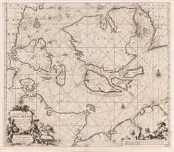
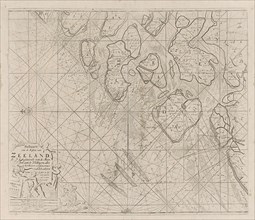
Sea chart of the Zeeland Islands and part of the N...
LZT16A27_419
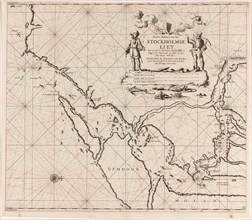
Map of the waters around Stockholm, Jan Luyken, Jo...
LZT16A27_428
Sea chart of part of the coast of Norway, print ma...
LZT16A27_450
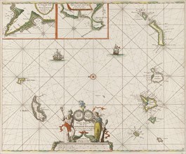
Sea chart of the Canary Islands, print maker: Jan ...
LZT16A29_389
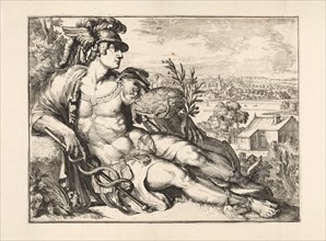
Mercury, Romeyn de Hooghe, 1688 - 1689
LZT16A27_341
Sea chart of a portion of the northeast coast of B...
LZT16A27_451
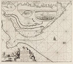
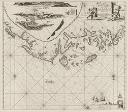
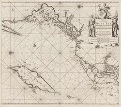
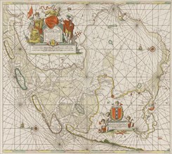
Sea chart of the Zuiderzee and the Wadden Sea, Jan...
LZT16A32_102
View of the Grote Kerk, Haarlem, Netherlands, Rome...
LZT16A27_415
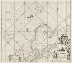
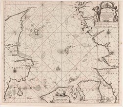
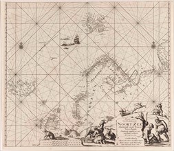
Sea chart of Northern part of Atlantic and Arctic ...
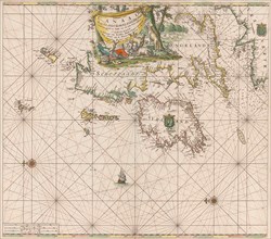
LZT16A27_440
Sea chart of the Strait of Gibraltar, Anonymous, J...
LZT16A31_439
Historical map of the Netherlands at the time of t...
LZT16A27_350
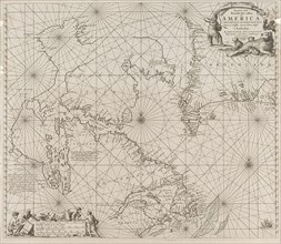
Sea chart a part of the coast of northern Canada a...
LZT16A27_393
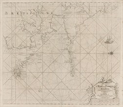
Sea chart of the coast of France between the islan...
LZT16A27_404
Sea chart of part of the east coast of England at ...
- Page
-
- sur
- 4