Légende
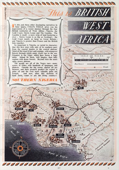
Map of 'British West Africa', 1952. A page taken from the 1952 'Empire Youth Album', entitled 'This is British West Africa', is illustrated with a scale map showing the location of British territories in western Africa including Nigeria, the Gold Coast, Sierra Leone and the Gambia. Western Africa, 1952., Western Africa, Africa.
Crédit
Photo12/Universal Images Group
Notre référence
UMG12A07_103
Licence
Droits gérés
Format disponible
65.1Mo (4.2Mo) / 33.9cm x 48.2cm / 3999 x 5688 (300dpi)