Légende
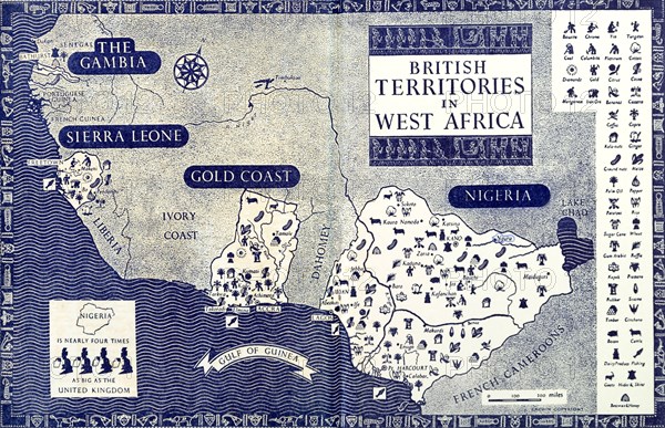
Map of 'British West Africa', 1952. A map taken from the inside covers of the 1952 'Empire Youth Annual', illustrates the location of British territories in western Africa including Nigeria, the Gold Coast, Sierra Leone and the Gambia. Western Africa, 1952., Western Africa, Africa.
Crédit
Photo12/Universal Images Group
Notre référence
UMG12A07_100
Licence
Droits gérés
Format disponible
54,6Mo (4,5Mo) / 46,0cm x 29,7cm / 5436 x 3510 (300dpi)