Sujet
'Map of the Tirah Campaign', c1900. Creator: Unknown.
Légende
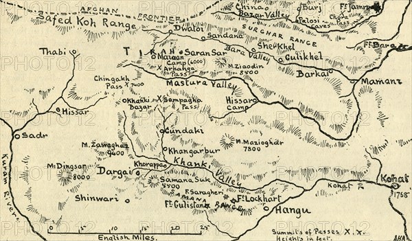
'Map of the Tirah Campaign', c1900. The Tirah expedition was an Indian frontier campaign from September 1897 to April 1898. Tirah is a mountainous tract of country in what was formally known as Federally Administered Tribal Areas of Pakistan, now Khyber Pakhtunkhwa province. Map showing towns and cities, rivers, forts, mountains and mountain passes, including the Afghan frontier, Surghar Range, Kuram River, Bazar Valley, Bara and Mastura Valleys. From "Cassell's History of England, Vol. IX". [Cassell and Company, Limited, London, Paris, New York & Melbourne]
Crédit
Photo12/Heritage Images/The Print Collector
Notre référence
HRM23A77_020
Model release
NA
Licence
Droits gérés
Format disponible
61.5Mo (3.7Mo) / 51.3cm x 30.1cm / 6060 x 3550 (300dpi)