Sujet
'Map of Hornsey and Neighbourhood in 1819', (c1876)
Légende
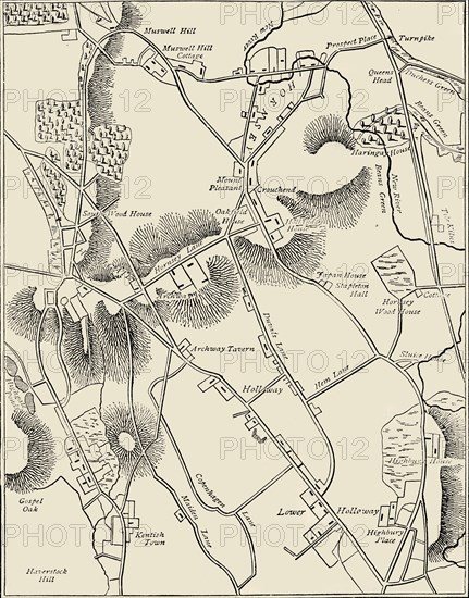
'Map of Hornsey and Neighbourhood in 1819', (c1876). . The village grew dramatically after c1860. From "Old and New London: A Narrative of Its History, Its People, and Its Places. The Western and Northern Studies", by Edward Walford. [Cassell, Petter, Galpin & Co., London, Paris & New York]
Date
1819
Crédit
Photo12/Heritage Images/The Print Collector
Notre référence
HRM19F23_063
Model release
Non
Licence
Droits gérés
Format disponible
69,1Mo (3,8Mo) / 36,9cm x 46,9cm / 4354 x 5544 (300dpi)