Sujet
England & Wales in the Winter of 1643-44', 1926. s
Légende
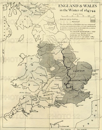
'England & Wales in the Winter of 1643-44', 1926. Map showing England and Wales during the Civil War period. The key shows districts held by the king (Charles I), and by parliament. 'The exact division of England into two allegiances is only very roughly accurate; civil war was swaying to and fro in many of the border districts eg Lancashire, Yorkshire, Lincolnshire and elsewhere. The Eastern Association in 1642 included Essex, Norfolk, Suffolk, Cambridge and Hertfordshire. Huntingdonshire was added in May 1643 and Lincolnshire in September 1643.' From "History of England", by George Macaulay Trevelyan. [Longmans, Green and Co. Ltd, London, 1926]
Date
1926
Crédit
Photo12/Heritage Images/The Print Collector
Notre référence
HRM19F13_445
Model release
Non
Licence
Droits gérés
Format disponible
63,1Mo (2,4Mo) / 35,3cm x 44,8cm / 4170 x 5290 (300dpi)